 |
| Home Page ... > Site Directory ... > GVRD Traffic ... > Mary Hill Bypass ... |
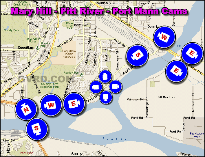
| Mary Hill Bypass Traffic ... | |
|
Add Site | Contact | Copyright GVRD.COM | Legal | Privacy Policy
Top of Page
|
|
Add Site | Contact | Copyright GVRD.COM | Legal | Privacy Policy Top of Page |